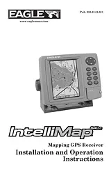
Manual De UsuarioTabla de contenidosSection 1: Read Me First!1Capabilities and Specifications: IntelliMap® 640c2How GPS Works4Introduction to GPS and WAAS6How to use this manual: typographical conventions8Arrow Keys8Keyboard8Menu Commands8Instructions = Menu Sequences8Section 2: Installation & Accessories11Preparations11GPS Antenna/Receiver Module Installation11Power Connections12NMEA Cable Connections14Mounting the Unit: Bracket, In-Dash or Portable15Bracket Installation16In-Dash Installation17Portable Installation18MMC or SD Card Memory Card Installation19To add an MMC or SD Card20Section 3: Basic GPS Operations23Keyboard23Power/lights on and off24Main Menu24Pages26Satellite Status Page26Navigation Page28Map Page30Background map vs. MapCreate map content32Resize Window command34Basic GPS Quick Reference36Find Your Current Position37Moving Around the Map: Zoom & Cursor Arrow Keys37Selecting Any Map Item with the Cursor38Searching38Set a Waypoint40To create and save a Waypoint:41Navigate To a Waypoint43Set Man Overboard (MOB) Waypoint44Navigate Back to MOB Waypoint44Navigate to Cursor Position on Map45Navigate to a Point of Interest46Creating and Saving a Trail46To Save a Trail47Displaying a Saved Trail48To turn off trail display:48To turn on trail display:48Navigating Trails48Visual Trailing49Navigate a Trail49Navigate a Back Trail51Transfer Custom Maps and GPS Data Files52Custom Maps:52GPS Data files:52Cancel Navigation54Section 4: Advanced GPS Operations55Find Distance From Current Position To Another Location55Find Distance From Point to Point55Icons56Create Icon on Map56Create Icon at Current Position56Delete an Icon57Navigate to an Icon57Routes57Create and Save a Route58Delete a Route60Edit a Route Name61Edit Route Waypoints61Navigate a Route62Navigate a Route in Reverse62Trails63Delete a Trail63Edit a Trail63Utilities65Alarm Clock65Sun/Moon Rise & Set Calculator65Trip Calculator65Trip Down Timer65Trip Up Timer65Waypoints65Delete a Waypoint65Delete a Waypoint from the map65Edit a Waypoint65Waypoint Symbol66Waypoint Position66Selecting a Waypoint66Set a Waypoint by Average Position66Set a Waypoint by Projecting a Position67Section 5: System & GPS Setup Options69Alarms69To change alarm settings:69Check MMC Files and Storage Space70Communications Port Configuration70Configure NMEA71Coordinate System Selection72To setup Loran TD:73Map Fix73To configure a map fix:74Customize Page Displays75Customize Satellite Status Page75GPS Simulator76To get to the GPS Simulator:76Simulating Trail or Route Navigation76Initialize GPS77Map Auto Zoom77Map Data78Earth Map Detail78Pop-up Map Information78Map Boundaries78Fill Water With White79Map Overlays (Range Rings; Lat/Long Grid)79Map Datum Selection79Map Detail Category Drawn80Map Orientation81NauticPath USA Marine Charts82Nautical Chart Notes82Port Information83Tidal Current Information84Tide Information86Navionics Charts87Overlay Data88To overlay information on your screen:89To remove overlaid data:90To move overlaid data:90Pop-up Help91Reset Options92Require WAAS92Screen Contrast and Brightness93Set Language93Set Local Time93Show WAAS Alarm94Software Version Information94Sounds and Alarm Sound Styles95Track Smoothing96Trail Options96Delete All Trails97Trail Update Rate97Delete Trail98New Trail98Trail Visibility and Other Trail Options98Transparency99Units of Measure100Section 6: Searching101Find Addresses102Find Any Item Selected by Map Cursor104Find Interstate Highway Exits104Find Map Places or Points of Interest (POI)106Find Streets or Intersections108Find Waypoints112Section 7: Supplemental Material115Tamaño: 3 MBPáginas: 136Language: EnglishManuales abiertas
Manual De UsuarioTabla de contenidosSection 1: Read Me First!1Capabilities and Specifications: IntelliMap® 640c2How GPS Works4Introduction to GPS and WAAS6How to use this manual: typographical conventions8Arrow Keys8Keyboard8Menu Commands8Instructions = Menu Sequences8Section 2: Installation & Accessories11Preparations11GPS Antenna/Receiver Module Installation11Power Connections12NMEA Cable Connections14Mounting the Unit: Bracket, In-Dash or Portable15Bracket Installation16In-Dash Installation17Portable Installation18MMC or SD Card Memory Card Installation19To add an MMC or SD Card20Section 3: Basic GPS Operations23Keyboard23Power/lights on and off24Main Menu24Pages26Satellite Status Page26Navigation Page28Map Page30Background map vs. MapCreate map content32Resize Window command34Basic GPS Quick Reference36Find Your Current Position37Moving Around the Map: Zoom & Cursor Arrow Keys37Selecting Any Map Item with the Cursor38Searching38Set a Waypoint40To create and save a Waypoint:41Navigate To a Waypoint43Set Man Overboard (MOB) Waypoint44Navigate Back to MOB Waypoint44Navigate to Cursor Position on Map45Navigate to a Point of Interest46Creating and Saving a Trail46To Save a Trail47Displaying a Saved Trail48To turn off trail display:48To turn on trail display:48Navigating Trails48Visual Trailing49Navigate a Trail49Navigate a Back Trail51Transfer Custom Maps and GPS Data Files52Custom Maps:52GPS Data files:52Cancel Navigation54Section 4: Advanced GPS Operations55Find Distance From Current Position To Another Location55Find Distance From Point to Point55Icons56Create Icon on Map56Create Icon at Current Position56Delete an Icon57Navigate to an Icon57Routes57Create and Save a Route58Delete a Route60Edit a Route Name61Edit Route Waypoints61Navigate a Route62Navigate a Route in Reverse62Trails63Delete a Trail63Edit a Trail63Utilities65Alarm Clock65Sun/Moon Rise & Set Calculator65Trip Calculator65Trip Down Timer65Trip Up Timer65Waypoints65Delete a Waypoint65Delete a Waypoint from the map65Edit a Waypoint65Waypoint Symbol66Waypoint Position66Selecting a Waypoint66Set a Waypoint by Average Position66Set a Waypoint by Projecting a Position67Section 5: System & GPS Setup Options69Alarms69To change alarm settings:69Check MMC Files and Storage Space70Communications Port Configuration70Configure NMEA71Coordinate System Selection72To setup Loran TD:73Map Fix73To configure a map fix:74Customize Page Displays75Customize Satellite Status Page75GPS Simulator76To get to the GPS Simulator:76Simulating Trail or Route Navigation76Initialize GPS77Map Auto Zoom77Map Data78Earth Map Detail78Pop-up Map Information78Map Boundaries78Fill Water With White79Map Overlays (Range Rings; Lat/Long Grid)79Map Datum Selection79Map Detail Category Drawn80Map Orientation81NauticPath USA Marine Charts82Nautical Chart Notes82Port Information83Tidal Current Information84Tide Information86Navionics Charts87Overlay Data88To overlay information on your screen:89To remove overlaid data:90To move overlaid data:90Pop-up Help91Reset Options92Require WAAS92Screen Contrast and Brightness93Set Language93Set Local Time93Show WAAS Alarm94Software Version Information94Sounds and Alarm Sound Styles95Track Smoothing96Trail Options96Delete All Trails97Trail Update Rate97Delete Trail98New Trail98Trail Visibility and Other Trail Options98Transparency99Units of Measure100Section 6: Searching101Find Addresses102Find Any Item Selected by Map Cursor104Find Interstate Highway Exits104Find Map Places or Points of Interest (POI)106Find Streets or Intersections108Find Waypoints112Section 7: Supplemental Material115Tamaño: 3 MBPáginas: 136Language: EnglishManuales abiertas
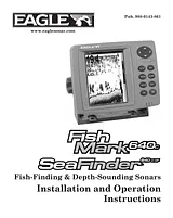
Guía Del UsuarioTabla de contenidosRead Me First!1Capabilities and Specifications: FishMark® 640c2SeaFinder® 640c DF2How Sonar Works4How to Use this Manual: Typographical Conventions5Arrow Keys5Keyboard5Menu Commands5Instructions = Menu Sequences5Section 2: Installation & Accessories7Preparations7Transducer Installation7Recommended Tools and Supplies8Selecting a Transducer Location9How low should you go?10Shoot-Thru-Hull vs. Transom Mounting11Transom Transducer Assembly and Mounting12Trolling Motor Bracket Installation (single-frequency only)19Transducer Orientation and Fish Arches20Shoot-Thru-Hull Preparation21Testing Determines Best Location22Shoot-Thru-Hull Installation24Speed/Temperature Sensors26Optional Speed Sensor Installation27Power Connections29Mounting the Unit: Bracket, In-Dash or Portable31Bracket Installation32In-Dash Installation34Portable Installation34Basic Sonar Operation37Keyboard37Power/lights on and off38Main Menu39Pages40Basic Sonar Quick Reference45Sonar Operations46Fish Symbols vs. Full Sonar Chart50Other Free Training Aids50Section 4: Sonar Options & Other Features52ASP (Advanced Signal Processing)53To change the ASP level54Alarms54Depth Alarms55Zone Alarm56Fish Alarm57Backlight and Contrast Level58Calibrate Speed59Chart Speed60ColorLine61Depth Cursor62Depth Range - Automatic63Depth Range - Manual64FasTrack65Fish I.D. (Fish Symbols & Depths)65To turn the Fish I.D. feature on67FishTrack67To turn on FishTrack67Frequency (Change Transducer Frequency) (SeaFinder only)68To change the frequency setting to 50 kHz69To change the frequency setting to 200 kHz69HyperScroll69Noise Rejection69Overlay Data69Ping Speed & HyperScroll72To change Ping Speed73To adjust Sensitivity73To turn off HyperScroll74Pop-up Help74Reset Options75Reset Water Distance76Set Keel Offset76Sensitivity & Auto Sensitivity78Automatic Sensitivity78To turn Auto Sensitivity back on79Set Language80Software Version Information80Sonar Chart Mode80To change the chart mode color scheme81Sonar Page & Sonar Chart Display Options81Full Sonar Chart81Split Zoom Sonar Chart82Digital Data/Chart83Sonar Simulator85Stop Chart86Surface Clarity87To adjust the Surface Clarity level87Transparency88To adjust Menu Transparency level89Units of Measure89Zoom & Zoom Bar90Zoom Pan91Section 5: Troubleshooting92Unit won't turn on93Unit operates only in demo mode93Unit freezes, locks up, or operates erratically93No fish arches when the Fish I.D. feature is off:95Noise95Section 6: Supplemental Material97Tamaño: 3 MBPáginas: 108Language: EnglishManuales abiertas
Guía De OperaciónTabla de contenidosRead Me First!1Capabilities and Specifications: FishMark® 640c2SeaFinder® 640c DF2How Sonar Works4How to Use this Manual: Typographical Conventions5Arrow Keys5Keyboard5Menu Commands5Instructions = Menu Sequences5Section 2: Installation & Accessories7Preparations7Transducer Installation7Recommended Tools and Supplies8Selecting a Transducer Location9How low should you go?10Shoot-Thru-Hull vs. Transom Mounting11Transom Transducer Assembly and Mounting12Trolling Motor Bracket Installation (single-frequency only)19Transducer Orientation and Fish Arches20Shoot-Thru-Hull Preparation21Testing Determines Best Location22Shoot-Thru-Hull Installation24Speed/Temperature Sensors26Optional Speed Sensor Installation27Power Connections29Mounting the Unit: Bracket, In-Dash or Portable31Bracket Installation32In-Dash Installation34Portable Installation34Basic Sonar Operation37Keyboard37Power/lights on and off38Main Menu39Pages40Basic Sonar Quick Reference45Sonar Operations46Fish Symbols vs. Full Sonar Chart50Other Free Training Aids50Section 4: Sonar Options & Other Features52ASP (Advanced Signal Processing)53To change the ASP level54Alarms54Depth Alarms55Zone Alarm56Fish Alarm57Backlight and Contrast Level58Calibrate Speed59Chart Speed60ColorLine61Depth Cursor62Depth Range - Automatic63Depth Range - Manual64FasTrack65Fish I.D. (Fish Symbols & Depths)65To turn the Fish I.D. feature on67FishTrack67To turn on FishTrack67Frequency (Change Transducer Frequency) (SeaFinder only)68To change the frequency setting to 50 kHz69To change the frequency setting to 200 kHz69HyperScroll69Noise Rejection69Overlay Data69Ping Speed & HyperScroll72To change Ping Speed73To adjust Sensitivity73To turn off HyperScroll74Pop-up Help74Reset Options75Reset Water Distance76Set Keel Offset76Sensitivity & Auto Sensitivity78Automatic Sensitivity78To turn Auto Sensitivity back on79Set Language80Software Version Information80Sonar Chart Mode80To change the chart mode color scheme81Sonar Page & Sonar Chart Display Options81Full Sonar Chart81Split Zoom Sonar Chart82Digital Data/Chart83Sonar Simulator85Stop Chart86Surface Clarity87To adjust the Surface Clarity level87Transparency88To adjust Menu Transparency level89Units of Measure89Zoom & Zoom Bar90Zoom Pan91Section 5: Troubleshooting92Unit won't turn on93Unit operates only in demo mode93Unit freezes, locks up, or operates erratically93No fish arches when the Fish I.D. feature is off:95Noise95Section 6: Supplemental Material97Tamaño: 3 MBPáginas: 108Language: EnglishManuales abiertas
Guía Del UsuarioTabla de contenidosSection 1: Read Me First!1Capabilities and Specifications:3How Eagle Sonar Works5How GPS Works6Introduction to GPS and WAAS7Free Training Aids Available10How to use this manual: typographical conventions11Arrow Keys11Keyboard11Menu Commands11Instructions = Menu Sequences11Section 2: Installation & Accessories13Preparations13Transducer Installation13Recommended Tools and Supplies14Single-frequency transom installations14Dual-frequency transom installations14Single-frequency trolling motor installations14Shoot-through hull installations14Selecting a Transducer Location14How low should you go?15Shoot-Thru-Hull vs. Transom Mounting16Transom Transducer Assembly and Mounting17Transducer Orientation and Fish Arches23Shoot-Thru-Hull Preparation24Hulls With Flotation Materials24Testing Determines Best Location24Shoot-Thru-Hull Installation26Speed/Temperature Sensors28Optional Speed Sensor Installation29Power Connections31Antenna/Receiver Module Installation32NMEA Cable Connections33NMEA Wiring33Mounting the Unit: Bracket, In-Dash or Portable33MMC or SD Card Memory Card Installation37Other Accessories38Section 3: Basic Sonar Operation41Keyboard41Power/lights on and off42Main Menu42Pages44Satellite Status Page44Navigation Page45Map Page45Sonar Page46Basic Sonar Quick Reference49Sonar Operations50Fish Symbols vs. Full Sonar Chart52Section 4: Sonar Options & Features53ASP (Advanced Signal Processing)53Alarms54Depth Alarms54Zone Alarm55Fish Alarm56Calibrate Speed56Chart Speed57ColorLine57Customize Page Displays59Depth Cursor60Depth Range - Automatic61Depth Range - Manual61FasTrack62Fish I.D.62FishTrack63Frequency (SeaCharter only)64HyperScroll65Log Sonar Chart Data65Noise Rejection66Overlay Data66Ping Speed & HyperScroll69Reset Options71Reset Water Distance71Set Keel Offset72Sensitivity & Auto Sensitivity73Automatic Sensitivity73Sonar Chart Mode74Sonar Page & Sonar Chart Display Options75Full Sonar Chart75Split Zoom Sonar Chart76Digital Data76Customizing the Digital Data Page76Map With Sonar78Sonar Simulator78Stop Chart80Surface Clarity80Zoom & Zoom Bar81Zoom Pan82Section 5: Sonar Troubleshooting83Section 6: Basic GPS Operations87Keyboard87Power/lights on and off88Main Menu88Pages90Sonar Page90Satellite Status Page90Navigation Page92Map Page94Background map vs. MapCreate map content96Resize Window command98Basic GPS Quick Reference100Find Your Current Position101Moving Around the Map: Zoom & Cursor Arrow Keys101Selecting Any Map Item With the Cursor102Searching102Set a Waypoint104Create Waypoint at Current Position105Create Waypoint on Map106Create Waypoint by Entering a Position106Navigate To a Waypoint107Set Man Overboard (MOB) Waypoint108Navigate Back to MOB Waypoint108Navigate to Cursor Position on Map108Navigate to a Point of Interest110Creating and Saving a Trail110Displaying a Saved Trail111Navigating Trails112Visual Trailing112Navigate a Trail112Navigate a Back Trail115Transfer Custom Maps and GPS Data Files115Cancel Navigation118Section 7: Advanced GPS Operations119Find Distance Current Position to Another Location119Find Distance From Point to Point119Icons120Create Icon on Map120Create Icon at Current Position120Delete an Icon120Navigate to an Icon121Routes121Create and Save a Route122PC-created Routes122Routes Created in the Unit122Delete a Route124Edit a Route Name125Edit Route Waypoints125Navigate a Route125Navigate a Route in Reverse126Trails127Delete a Trail127Edit a Trail Name127Edit a Trail Color127Edit a Trail Pattern127Utilities128Alarm Clock128Sun/Moon Rise & Set Calculator128Trip Calculator128Trip Down Timer128Trip Up Timer128Waypoints128Delete a Waypoint128Edit a Waypoint129Selecting a Waypoint130Set a Waypoint by Average Position130Set a Waypoint by Projecting a Position130Section 8: System & GPS Setup131Alarms131Check MMC Files and Storage Space132Communications Port Configuration132Configure NMEA133Coordinate System Selection134Map Fix135Customize Page Displays137GPS Simulator138Hide GPS Features140Initialize GPS140Map Auto Zoom141Map Data141Earth Map Detail141Pop-up Map Information142Draw Map Boundaries142Fill Water With White142Map Overlays (Range Rings; Lat/Long Grid)142Map Datum Selection142Map Detail Category Drawn143Map Orientation144NauticPath USA Marine Charts145Nautical Chart Notes145Port Information146Tidal Current Information147Tide Information149Navionics Charts150Pop-up Help151Reset Options152Require WAAS152Screen Contrast and Brightness153Set Language154Set Local Time154Show WAAS Alarm154Software Version Information155Sounds Menu156Track Smoothing156Trail Options157General Trail Options157Specific Trail Options159Delete Trail159New Trail159Trail Visibility and Other Trail Options159Transparency159Units of Measure160Section 9: Searching161Find Addresses162Find Any Item Selected by Map Cursor164Find Interstate Highway Exits165Find Map Places or Points of Interest (POI)167Find Streets or Intersections169Find a Street169Find an Intersection170Find Waypoints172Section 10: Supplemental Material175Tamaño: 7 MBPáginas: 196Language: EnglishManuales abiertas