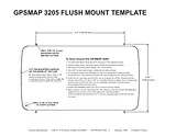
Owner's ManualTable of ContentsGPSMAP 32051Introduction3Installing Your GPSMAP 32053About This Manual3Manual Conventions3Product Registration7Software License Agreement7Warning8Caution8Getting Started9Unit Overview9Using the GPSMAP 3205 Keypad10Using Soft Keys11Status Bar11Turning on the GPSMAP 320511Adjusting the Backlight12Initializing the GPS Receiver12Receiver Status and Accuracy13GPS Setup13Using Simulator Mode14Basic Operation16Using the GPSMAP 320516Understanding the Features16Selecting Options and Entering Data17Using Additional Map Data17Using the Map Pointer18Finding an Item19Creating and Using Waypoints20Creating Waypoints Using the ENTER/MARK Key20Creating Waypoints Graphically21Creating Waypoints Manually22Reviewing and Editing Waypoints23Projecting a Waypoint24Referencing a Waypoint25Using Waypoint Lists25User Waypoints25Proximity Waypoints26Navigating to a Destination27Selecting a Go To Destination Graphically28Follow Track and TracBack Navigation28TracBack Tips31Man OverBoard (MOB)31Creating and Using Routes32Creating a New Route32Navigating a Saved Route33Creating a Quick NAV Route34Copying a Route34Deleting a Route34Editing a Route34Planning Routes37Main Pages38Configuring Main Pages39Using Function Windows41Function Window Adjustments41Viewing a Main Page in Full-Screen Mode42Map Page42Using the Map Pointer43Selecting Map Ranges44Cartography44Map Page Options45Map Split Page47Compass Page47Highway Page48Changing the Highway Perspective Range49Highway Page Options49Main Menu50GPS Tab50Tide Tab51Tide Sub Tab51Current Sub Tab53Celestial Tab54Trip Tab55Weather Tab56Points Tab56Routes Tab57Tracks Tab58DSC (Digital Selective Calling) Tab59Understanding DSC Distress Calls60Understanding Position Reports60Review DSC Waypoint60Setting Up DSC61Using the NAV Key61Card Tab62Messages Tab63Viewing Detailed Message Information63Alarms Tab64System Alarms64Nav (Navigation) Alarms65Sonar Alarms*65System Tab66Update Sub Tab71Network Tab71Pages Tab72Map Tab73AIS Sub Tab76Temp (Temperature) Tab78Sonar Tab78Highway Tab79XM Tab79Using Favorites80Using Sonar81Understanding Sonar81Using Dual Frequency81Using Dual Beam81Understanding the Sonar Display82Sonar Page83Configuring the Sonar Page84Using the Sonar Adjustment Menu84Using the Pointer on the Sonar Page86Marking an Underwater Waypoint86Sonar Tab86General Sub Tab87Graph Sub Tab88Water Temp Sub Tab89XM WX Weather90Customizing Preset Weather Displays90Weather Tab92Marine Bulletins Sub Tab92Appendix93Specifications93Installing and Removing the Data Card94Satellite Information95What is WAAS/EGNOS?95WAAS Capability96Digital Selective Calling (DSC)96LORAN TD System98Caring for the GPSMAP 320599Navigation Terms100Messages and Alarms102Optional Accessories104Limited Warranty105FCC Compliance106XM Satellite Radio Service Agreement106Weather Data Warranty107Index108Size: 8.54 MBPages: 112Language: EnglishOpen manual