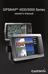
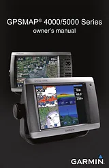
Manuale UtenteSommarioIntroduction3Tips and Shortcuts3Manual Conventions3Quick Links3Getting Started5Unit Overview5Turning the Unit On or Off6Initializing Unit Settings6Adjusting the Backlight7Acquiring GPS Satellite Signals7Inserting and Removing SD Cards8Restoring Factory Settings8Viewing System Information8Using Simulator Mode8Understanding the Home Screen9Using Charts10Using the Navigation Chart10Changing the Navigation Chart Settings13Using Radar Overlay16Using Tracks16Using BlueChart g2 Vision18Using Mariner’s Eye 3D18Using Fish Eye 3D20Using Fishing Charts20Enabling High-Resolution Satellite Imagery21Viewing Aerial Photos22Viewing Current Station Information22Detailed Road and POI Data22Using Automatic Guidance22Using Combinations23Where To?25Navigating to a Destination25Creating and Using Waypoints27Creating and Using Routes29Navigating with a Garmin Autopilot30Viewing Information31Viewing Tide Station Information31Viewing Current Information31Viewing Celestial Information32Viewing User Data32Viewing the DSC List34Viewing Fuel Gauges35Viewing Video35Configuring the Chartplotter36Configuring System Settings36Changing the System Language36Configuring Navigation Preferences36Configuring Units of Measure37Configuring Communications Settings37Setting Alarms38Setting the Total Fuel Onboard Alarm39Configuring My Boat39Configuring Other Vessels40Using the Garmin Marine Network41Viewing Connected Garmin Marine Network Devices42Using Radar43Using Cruising Mode44Using Sentry Mode44Radar Targeting45Understanding the Radar Overlay Screen46Obtaining Optimal Radar Display Performance46Adjusting the VRM and EBL47Configuring Other Vessels on the Radar Screen47Advanced Radar Configuration48Using Sonar49Understanding the Full Screen49Understanding the Split Zoom Screen49Understanding the Split Frequency Screen50Understanding the Temp Log50Setting Up Sonar51Advanced Sonar Settings52Digital Selective Calling53Using the Chartplotter with a VHF Radio53Adding a DSC Contact53Viewing the DSC List54Receiving Distress Calls54Man-Overboard Distress Calls Initiated from a VHF Radio54Man-Overboard Distress Calls Initiated from the Chartplotter54Position Tracking55Placing an Individual Routine Call56Calling an AIS Target56Appendix57Specifications57Calibrating the Touchscreen58Capturing Screenshots58Alarms and Messages59Product Registration61Contact Garmin61Declaration of Conformity (DoC)61Software License Agreement61NMEA 0183 and NMEA 200062Index63Dimensioni: 4,74 MBPagine: 68Language: EnglishApri il manuale
Manuale UtenteSommarioIntroduction3Tips and Shortcuts3Manual Conventions3Quick Links3Getting Started5Unit Overview5Turning the Unit On or Off6Initializing Unit Settings6Adjusting the Backlight7Acquiring GPS Satellite Signals7Inserting and Removing SD Cards8Restoring Factory Settings8Viewing System Information8Using Simulator Mode8Understanding the Home Screen9Using Charts10Using the Navigation Chart10Changing the Navigation Chart Settings13Using Radar Overlay16Using Tracks16Using BlueChart g2 Vision18Using Mariner’s Eye 3D18Using Fish Eye 3D20Using Fishing Charts20Enabling High-Resolution Satellite Imagery21Viewing Aerial Photos22Viewing Current Station Information22Detailed Road and POI Data22Using Automatic Guidance22Using Combinations23Where To?25Navigating to a Destination25Creating and Using Waypoints27Creating and Using Routes29Navigating with a Garmin Autopilot30Viewing Information31Viewing Tide Station Information31Viewing Current Information31Viewing Celestial Information32Viewing User Data32Viewing the DSC List34Viewing Fuel Gauges35Viewing Video35Configuring the Chartplotter36Configuring System Settings36Changing the System Language36Configuring Navigation Preferences36Configuring Units of Measure37Configuring Communications Settings37Setting Alarms38Setting the Total Fuel Onboard Alarm39Configuring My Boat39Configuring Other Vessels40Using the Garmin Marine Network41Viewing Connected Garmin Marine Network Devices42Using Radar43Using Cruising Mode44Using Sentry Mode44Radar Targeting45Understanding the Radar Overlay Screen46Obtaining Optimal Radar Display Performance46Adjusting the VRM and EBL47Configuring Other Vessels on the Radar Screen47Advanced Radar Configuration48Using Sonar49Understanding the Full Screen49Understanding the Split Zoom Screen49Understanding the Split Frequency Screen50Understanding the Temp Log50Setting Up Sonar51Advanced Sonar Settings52Digital Selective Calling53Using the Chartplotter with a VHF Radio53Adding a DSC Contact53Viewing the DSC List54Receiving Distress Calls54Man-Overboard Distress Calls Initiated from a VHF Radio54Man-Overboard Distress Calls Initiated from the Chartplotter54Position Tracking55Placing an Individual Routine Call56Calling an AIS Target56Appendix57Specifications57Calibrating the Touchscreen58Capturing Screenshots58Alarms and Messages59Product Registration61Contact Garmin61Declaration of Conformity (DoC)61Software License Agreement61NMEA 0183 and NMEA 200062Index63Dimensioni: 4,74 MBPagine: 68Language: EnglishApri il manuale
Manuale UtenteSommarioIntroduction3Tips and Shortcuts3Manual Conventions3Quick Links3Getting Started5Unit Overview5Turning the Unit On or Off6Adjusting the Backlight6Acquiring GPS Satellite Signals7Inserting and Removing SD Cards7Restoring Factory Settings7Viewing System Information7Using the Simulator Mode8Understanding the Home Screen8Using Charts9Using the Navigation Chart9Zooming In and Out on the Map9Navigation Chart Settings9Understanding Chart Data9Navigating to a Point on the Chart10Panning the Navigation Chart10Accessing Additional Object Information11Viewing Tide-Station Information11Using Mariner’s Eye12Mariner’s Eye Settings12Changing the Chart Settings13Changing the Chart Appearance13Using Tracks14Using BlueChart g2 Vision15Using Mariner’s Eye 3D16Mariner’s Eye 3D Settings16Using Fish Eye 3D17Fish Eye 3D Settings17Using Fishing Charts17Enabling High-Resolution Satellite Imagery18Viewing Aerial Photos19Viewing Current Station Information19Detailed Road and POI Data19Using Automatic Guidance19Using Combinations20Where To?22Navigating to a Destination22Creating and Using Waypoints24Creating and Using Routes26Viewing Information28Viewing Tide Station Information28Viewing Current Information28Viewing Celestial Information29Viewing User Data29Viewing Other Boats30Viewing Engine Gauges31Viewing Fuel Gauges31Viewing Video32Configuring the Chartplotter33Configuring System Settings33Changing Units of Measure33Configuring Communications Settings34Setting Alarms34Setting Navigation Alarms35Setting System Alarms35Setting Sonar Alarms35Configuring My Boat35Configuring Other Boats36Using the Garmin Marine Network37Viewing Connected Garmin Marine Network Devices38Using Radar39Understanding the Cruising Screen40Cruising Screen Settings40Targeting on the Cruising Screen41Understanding the Radar Overlay Screen42Using Sonar43Understanding the Full Screen43Understanding the Split Zoom Screen43Understanding the Split Frequency Screen44Understanding the Temp Log44Setting Up Sonar45Advanced Sonar Settings46Appendix47Specifications47Physical Specifications47GPS Performance (with GPS 17 antenna)47Power48NMEA 2000 Specifications:48Initializing Unit Settings48Calibrating the Touchscreen48Alarms and Messages49Product Registration51Contact Garmin51Declaration of Conformity (DoC)51Software License Agreement51NMEA 0183 and NMEA 200052NMEA 018352Approved NMEA 0183 sentences:52NMEA 200052Index53Dimensioni: 5,14 MBPagine: 56Language: EnglishApri il manuale
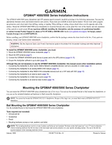
Istruzione Sull'InstallazioneSommarioGPSMAP® 4000/5000 Series Installation Instructions1Mounting the GPSMAP 4000/5000 Series Chartplotter1Bail Mounting the GPSMAP 4000/5000 Series Chartplotter1Flush Mounting the GPSMAP 4000/5000 Series Chartplotter2Flush Mounting a GPSMAP 4008/4208/4012/4212 Chartplotter or a GPSMAP 5008/5208/5012/5212 Chartplotter2Flush Mounting a GPSMAP 4010/4210 Chartplotter or a GPSMAP 5015/5215 Chartplotter:4Mounting the GPS Antenna5Choosing a location for the GPS antenna5GPS 175GPS 17x5Mounting a GPS 17 Antenna6Surface Mounting the GPS 17 Antenna6Pole Mounting the GPS 17 Antenna6Mounting a GPS 17x Antenna7Surface-mounting the GPS 17x Antenna7Pole Mounting the GPS 17x Antenna8Under-deck-mounting the GPS 17x Antenna8Wiring and Cables9Wiring the Power Cable9Wiring the GPS 17 Antenna9Connecting the GPSMAP 4000/5000 Series Chartplotter and the GPS 17x Antenna to Your NMEA 2000 Network10Connecting to an Existing NMEA 2000 network10Creating a basic NMEA 2000 Network11Wiring a Garmin Marine Network12The Garmin Marine Network Cable:12Wiring Additional NMEA 0183 Devices15Basic NMEA 0183 Wiring15Advanced NMEA 0183 Wiring16Wiring to an Optional Alarm18Wiring to a DB-9 PC Serial Connector18Marine Video Cable19Making the Final Connections to the GPSMAP 4000/5000 Series Chartplotter20Updating the Chartplotter Software20Specifications21NMEA 2000 PGN Information21Physical Specifications21Power21GPS 17 Antenna Drilling Template23Dimensioni: 3,68 MBPagine: 24Language: EnglishApri il manuale
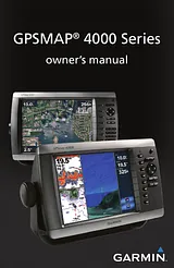
Manuale ProprietarioSommarioGPSMAP 4000 Series Owner's Manual1Introduction3Tips and Shortcuts3Manual Conventions3Quick Links3Warnings6Important Information6Getting Started7Unit Overview7Front and Rear Panels7Power/Backlight8Acquiring GPS Satellite Signals9Inserting and Removing SD Cards10System Settings10Understanding the Home Screen11Using Charts13Using the Navigation Chart13Using Mariner’s Eye17Changing the Chart Settings18Using BlueChart g2 Vision20Using Mariner’s Eye 3D21Using Fish Eye 3D22Using Fishing Charts22Enabling High Resolution Satellite Imagery23Viewing Aerial Photos24Viewing Current Station Information26Detailed Road and POI Data26Using Automatic Guidance26Using Combinations27Using Where To29Navigating to a Destination29Creating and Using Waypoints31Creating and Using Routes33Viewing Information35Viewing Tide Station Information35Viewing Current Information35Viewing Celestial Information36Viewing User Data37Viewing Information on Other Boats38Viewing Gauges39Viewing Video40Configuring the Unit41Configuring System Settings41Changing Units of Measure41Configuring Communications Settings42Setting Alarms43Configuring My Boat44Configuring Other Boats46Configuring XM Audio46Using the Marine Network47Viewing Connected Garmin Marine Network Devices48Using Radar49Understanding the Cruising Screen50Understanding the Radar Overlay Screen53Radar Setup54Using Sonar55Understanding the Full Screen55Understanding the Split Zoom Screen55Understanding the Split Frequency Screen56Understanding the Temp Log56Setting Up Sonar57Advanced Sonar Settings58Using XM WX Weather and Audio59Using XM WX Weather59Setting the XM WX Weather Options59Viewing Precipitation Information59Viewing Forecast Information62Viewing Sea Conditions63Viewing Fishing Information64Viewing Visibility Information65Viewing Buoy Reports65Using XM Audio66Appendix67Specifications67Initializing Unit Settings68Messages and Alarms69Product Registration72Caring for the Unit72NMEA 0183 and NMEA 200073FCC Compliance74Declaration of Conformity (DoC)74Limited Warranty75Software License Agreement76Index77Dimensioni: 5,09 MBPagine: 80Language: EnglishApri il manuale
Guida UtenteSommarioIntroduction3Tips and Shortcuts3Manual Conventions3Quick Links3Getting Started5Unit Overview5Turning the Unit On or Off6Initializing Unit Settings6Adjusting the Backlight7Acquiring GPS Satellite Signals7Inserting and Removing SD Cards8Restoring Factory Settings8Viewing System Information8Using Simulator Mode8Understanding the Home Screen9Using Charts10Using the Navigation Chart10Changing the Navigation Chart Settings13Using Radar Overlay16Using Tracks16Using BlueChart g2 Vision18Using Mariner’s Eye 3D18Using Fish Eye 3D20Using Fishing Charts20Enabling High-Resolution Satellite Imagery21Viewing Aerial Photos22Viewing Current Station Information22Detailed Road and POI Data22Using Automatic Guidance22Using Combinations23Where To?25Navigating to a Destination25Creating and Using Waypoints27Creating and Using Routes29Navigating with a Garmin Autopilot30Viewing Information31Viewing Tide Station Information31Viewing Current Information31Viewing Celestial Information32Viewing User Data32Viewing the DSC List34Viewing Fuel Gauges35Viewing Video35Configuring the Chartplotter36Configuring System Settings36Changing the System Language36Configuring Navigation Preferences36Configuring Units of Measure37Configuring Communications Settings37Setting Alarms38Setting the Total Fuel Onboard Alarm39Configuring My Boat39Configuring Other Vessels40Using the Garmin Marine Network41Viewing Connected Garmin Marine Network Devices42Using Radar43Using Cruising Mode44Using Sentry Mode44Radar Targeting45Understanding the Radar Overlay Screen46Obtaining Optimal Radar Display Performance46Adjusting the VRM and EBL47Configuring Other Vessels on the Radar Screen47Advanced Radar Configuration48Using Sonar49Understanding the Full Screen49Understanding the Split Zoom Screen49Understanding the Split Frequency Screen50Understanding the Temp Log50Setting Up Sonar51Advanced Sonar Settings52Digital Selective Calling53Using the Chartplotter with a VHF Radio53Adding a DSC Contact53Viewing the DSC List54Receiving Distress Calls54Man-Overboard Distress Calls Initiated from a VHF Radio54Man-Overboard Distress Calls Initiated from the Chartplotter54Position Tracking55Placing an Individual Routine Call56Calling an AIS Target56Appendix57Specifications57Calibrating the Touchscreen58Capturing Screenshots58Alarms and Messages59Product Registration61Contact Garmin61Declaration of Conformity (DoC)61Software License Agreement61NMEA 0183 and NMEA 200062Index63Dimensioni: 4,74 MBPagine: 68Language: EnglishApri il manuale