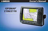
オーナーマニュアル目次GPSMAP 2106/2110 Owner's Manual1Introduction3Installing Your GPSMAP 2106/21103About This Manual3Manual Conventions3Product Registration7Contact Garmin7Software License Agreement7Warning8Caution8Getting Started9Unit Overview9Using the GPSMAP 2106/2110 Keypad10Using Soft Keys11Using Data Entry/Shortcut Keys11Status Bar11Turning on the GPSMAP 2106/211012Adjusting the Backlight12Initializing the GPS Receiver13Receiver Status and Accuracy14GPS Setup14Using Simulator Mode15Basic Operation16Using the GPSMAP 2106/211016Selecting Options and Entering Data17Using Additional Map Data18Using the Map Pointer18Finding an Item20Creating and Using Waypoints21Creating Waypoints Using the ENTER/MARK Key21Creating Waypoints Using the Map21Creating Waypoints Manually22Reviewing and Editing Waypoints23Moving a Waypoint24Using Waypoint Lists25User Waypoints25Proximity Waypoints26Navigating to a Destination27Selecting a Map Item Go To Destination28Follow Track and TracBack Navigation28TracBack Tips30Man OverBoard (MOB)31Creating and Using Routes31Creating a New Route31Navigating a Saved Route32Creating a Quick NAV Route33Copying a Route33Deleting a Route34Editing a Route34Planning Routes37Main Pages38Configuring Main Pages39Using Function Windows41Function Window Adjustments41Viewing a Main Page in Full-Screen Mode42Map Page42Selecting Map Ranges43Cartography44Map Page Options45Map Split Page47Compass Page48Highway Page49Changing the Highway Perspective Range49Highway Page Options49Showing or Hiding Cartography50Main Menu51GPS Tab51Tide Tab52Tide Sub Tab52Current Sub Tab54Celestial Tab55Trip Tab56Points Tab57Routes Tab58Tracks Tab58DSC (Digital Selective Calling) Tab60Understanding DSC Distress Calls60Understanding Position Reports60Review DSC Waypoint61Setting Up DSC62Using the NAV Key62Card Tab62Messages Tab63Viewing Detailed Message Information63Alarms Tab64System Alarms65Nav (Navigation) Alarms65Sonar Alarms*66System Tab66Update Sub Tab71Network Tab72Pages Tab72Map Tab73AIS Sub Tab77Temp (Temperature) Tab78Sonar Tab79Highway Tab79Using Sonar80Understanding Sonar80Using Dual Frequency80Using Dual Beam80Understanding the Sonar Display81Sonar Page82Configuring the Sonar Page83Using the Sonar Adjustment Menu84Using the Pointer on the Sonar Page86Marking an Underwater Waypoint86Sonar Tab86General Sub Tab87Graph Sub Tab88Water Temp Sub Tab89Appendix90Specifications90Installing and Removing Data Cards91What is WAAS/EGNOS?92WAAS Capability92Digital Selective Calling (DSC)93What is DSC?93LORAN TD System94Caring for the GPSMAP 2106/211095Navigation Terms96Messages and Alarms98Optional Accessories100Limited Warranty101FCC Compliance102Declaration of Conformity (DoC)102Index103サイズ: 5.77MBページ数: 106Language: Englishマニュアルを開く
オーナーマニュアル目次GPSMAP 2106/2110 Owner's Manual1Introduction3Installing Your GPSMAP 2106/21103About This Manual3Manual Conventions3Product Registration7Contact Garmin7Software License Agreement7Warning8Caution8Getting Started9Unit Overview9Using the GPSMAP 2106/2110 Keypad10Using Soft Keys11Using Data Entry/Shortcut Keys11Status Bar11Turning on the GPSMAP 2106/211012Adjusting the Backlight12Initializing the GPS Receiver13Receiver Status and Accuracy14GPS Setup14Using Simulator Mode15Basic Operation16Using the GPSMAP 2106/211016Selecting Options and Entering Data17Using Additional Map Data18Using the Map Pointer18Finding an Item20Creating and Using Waypoints21Creating Waypoints Using the ENTER/MARK Key21Creating Waypoints Using the Map21Creating Waypoints Manually22Reviewing and Editing Waypoints23Moving a Waypoint24Using Waypoint Lists25User Waypoints25Proximity Waypoints26Navigating to a Destination27Selecting a Map Item Go To Destination28Follow Track and TracBack Navigation28TracBack Tips30Man OverBoard (MOB)31Creating and Using Routes31Creating a New Route31Navigating a Saved Route32Creating a Quick NAV Route33Copying a Route33Deleting a Route34Editing a Route34Planning Routes37Main Pages38Configuring Main Pages39Using Function Windows41Function Window Adjustments41Viewing a Main Page in Full-Screen Mode42Map Page42Selecting Map Ranges43Cartography44Map Page Options45Map Split Page47Compass Page48Highway Page49Changing the Highway Perspective Range49Highway Page Options49Showing or Hiding Cartography50Main Menu51GPS Tab51Tide Tab52Tide Sub Tab52Current Sub Tab54Celestial Tab55Trip Tab56Points Tab57Routes Tab58Tracks Tab58DSC (Digital Selective Calling) Tab60Understanding DSC Distress Calls60Understanding Position Reports60Review DSC Waypoint61Setting Up DSC62Using the NAV Key62Card Tab62Messages Tab63Viewing Detailed Message Information63Alarms Tab64System Alarms65Nav (Navigation) Alarms65Sonar Alarms*66System Tab66Update Sub Tab71Network Tab72Pages Tab72Map Tab73AIS Sub Tab77Temp (Temperature) Tab78Sonar Tab79Highway Tab79Using Sonar80Understanding Sonar80Using Dual Frequency80Using Dual Beam80Understanding the Sonar Display81Sonar Page82Configuring the Sonar Page83Using the Sonar Adjustment Menu84Using the Pointer on the Sonar Page86Marking an Underwater Waypoint86Sonar Tab86General Sub Tab87Graph Sub Tab88Water Temp Sub Tab89Appendix90Specifications90Installing and Removing Data Cards91What is WAAS/EGNOS?92WAAS Capability92Digital Selective Calling (DSC)93What is DSC?93LORAN TD System94Caring for the GPSMAP 2106/211095Navigation Terms96Messages and Alarms98Optional Accessories100Limited Warranty101FCC Compliance102Declaration of Conformity (DoC)102Index103サイズ: 5.77MBページ数: 106Language: Englishマニュアルを開く
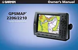
オーナーマニュアル目次GPSMAP 2206/22101Introduction3Installing Your GPSMAP 2106/21103About This Manual3Manual Conventions3Product Registration7Contact Garmin7Software License Agreement7Warning8Caution8Getting Started9Unit Overview9Using the GPSMAP 2106/2110 Keypad10Using Soft Keys11Using Data Entry/Shortcut Keys11Status Bar11Turning on the GPSMAP 2106/211012Adjusting the Backlight12Initializing the GPS Receiver13Receiver Status and Accuracy14GPS Setup14Using Simulator Mode15Basic Operation16Using the GPSMAP 2106/211016Selecting Options and Entering Data17Using Additional Map Data18Using the Map Pointer18Finding an Item20Creating and Using Waypoints21Creating Waypoints Using the ENTER/MARK Key21Creating Waypoints Using the Map21Creating Waypoints Manually22Reviewing and Editing Waypoints23Moving a Waypoint24Using Waypoint Lists25User Waypoints25Proximity Waypoints26Navigating to a Destination27Selecting a Map Item Go To Destination28Follow Track and TracBack Navigation28TracBack Tips30Man OverBoard (MOB)31Creating and Using Routes31Creating a New Route31Navigating a Saved Route32Creating a Quick NAV Route33Copying a Route33Deleting a Route34Editing a Route34Planning Routes37Main Pages38Configuring Main Pages39Using Function Windows41Function Window Adjustments41Viewing a Main Page in Full-Screen Mode42Map Page42Selecting Map Ranges43Cartography44Map Page Options45Map Split Page47Compass Page48Highway Page49Changing the Highway Perspective Range49Highway Page Options49Showing or Hiding Cartography50Main Menu51GPS Tab51Tide Tab52Tide Sub Tab52Current Sub Tab54Celestial Tab55Trip Tab56Points Tab57Routes Tab58Tracks Tab58DSC (Digital Selective Calling) Tab60Understanding DSC Distress Calls60Understanding Position Reports60Review DSC Waypoint61Setting Up DSC62Using the NAV Key62Card Tab62Messages Tab63Viewing Detailed Message Information63Alarms Tab64System Alarms65Nav (Navigation) Alarms65Sonar Alarms*66System Tab66Update Sub Tab71Network Tab72Pages Tab72Map Tab73AIS Sub Tab76Temp (Temperature) Tab78Sonar Tab79Highway Tab79Using Sonar80Understanding Sonar80Using Dual Frequency80Using Dual Beam80Understanding the Sonar Display81Sonar Page82Configuring the Sonar Page83Using the Sonar Adjustment Menu84Using the Pointer on the Sonar Page86Marking an Underwater Waypoint86Sonar Tab86General Sub Tab87Graph Sub Tab88Water Temp Sub Tab89Appendix90Specifications90Installing and Removing Data Cards91What is WAAS/EGNOS?92WAAS Capability92Digital Selective Calling (DSC)93What is DSC?93LORAN TD System94Caring for the GPSMAP 2106/211095Navigation Terms96Messages and Alarms98Optional Accessories100Limited Warranty101FCC Compliance102Industry Canada Compliance102Declaration of Conformity (DoC)102Index103サイズ: 3.35MBページ数: 106Language: Englishマニュアルを開く
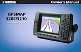
オーナーマニュアル目次GPSMAP 3206/3210 Owner's Manual1Introduction3Installing Your GPSMAP 3206/32103About This Manual3Manual Conventions3Product Registration7Contact Garmin7Tell Us What You Think7Software License Agreement7Warning8Caution8Getting Started9Unit Overview9Using the GPSMAP 3206/3210 Keypad10Using the Optional Marine Remote Control11Using Soft Keys12Using Data Entry/Shortcut Keys12Status Bar12Turning on the GPSMAP 3206/321013Adjusting the Backlight13Initializing the GPS Receiver14Receiver Status and Accuracy15GPS Setup15Using Simulator Mode16Basic Operation17Using the GPSMAP 3206/321017Understanding the Features17Selecting Options and Entering Data18Using Additional Map Data19Using the Map Pointer19Finding an Item21Creating and Using Waypoints22Creating Waypoints Using the ENTER/MARK Key22Creating Waypoints Using the Map22Creating Waypoints Manually23Reviewing and Editing Waypoints24Moving a Waypoint26Using Waypoint Lists26User Waypoints27Proximity Waypoints28Navigating to a Destination29Selecting a Map Item Go To Destination29Follow Track and TracBack Navigation30TracBack Tips32Man OverBoard (MOB)33Creating and Using Routes33Creating a New Route33Navigating a Saved Route34Creating a Quick NAV Route35Copying a Route35Deleting a Route36Editing a Route36Planning Routes39Main Pages40Configuring Main Pages41Using Function Windows43Function Window Adjustments43Viewing a Main Page in Full-Screen Mode44Map Page44Using the Map Pointer45Selecting Map Ranges46Cartography46Map Page Options47Map Split Page49Compass Page49Highway Page50Changing the Highway Perspective Range51Highway Page Options51Video Page52Video Page Options52Main Menu53GPS Tab53Tide Tab54Tide Sub Tab54Current Sub Tab56Celestial Tab57Trip Tab58Weather Tab59Points Tab59Routes Tab60Tracks Tab61DSC (Digital Selective Calling) Tab62Understanding DSC Distress Calls63Understanding Position Reports63Review DSC Waypoint63Setting Up DSC64Using the NAV Key64Card Tab65Messages Tab66Viewing Detailed Message Information66Alarms Tab66System Alarms67Nav (Navigation) Alarms67Sonar Alarms*67Weather Alarms**68System Tab68Update Sub Tab73Network Tab74Pages Tab74Map Tab75AIS Sub Tab78Radar Tab80Temp (Temperature) Tab80Sonar Tab81Highway Tab81XM Tab82Using Sonar84Understanding Sonar84Using Dual Frequency84Using Dual Beam84Understanding the Sonar Display85Sonar Page86Configuring the Sonar Page87Using the Sonar Adjustment Menu88Using the Pointer on the Sonar Page90Marking an Underwater Waypoint90Sonar Tab90General Sub Tab91Graph Sub Tab92Water Temp Sub Tab93XM WX Weather94Customizing Preset Weather Displays94Weather Tab96Marine Bulletins Sub Tab96Using Radar97Understanding Radar97Understanding the Radar Display98Radar Page99Configuring the Radar Page99Using the Radar Adjustment Menu100Map Page Radar Overlay105Radar Tab105General Sub Tab106Display Sub Tab106MARPA Sub Tab107Advanced Sub Tab108Appendix109Specifications109Installing and Removing Data Cards110Satellite Information111What is WAAS/EGNOS?111WAAS Capability112Digital Selective Calling (DSC)112What is DSC?112LORAN TD System114Caring for the GPSMAP 3206/3210115Navigation Terms116Messages and Alarms118Optional Accessories120Limited Warranty121FCC Compliance122XM Satellite Radio Service Agreement122Declaration of Conformity (DoC)122Weather Data Warranty123European License Requirements124Index125サイズ: 7.52MBページ数: 130Language: Englishマニュアルを開く
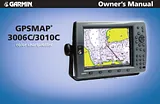
オーナーマニュアル目次Introduction3Installing Your GPSMAP 3006C/3010C3About This Manual3Manual Conventions3Product Registration7Contact Garmin7Software License Agreement7Warning8Caution8Getting Started9Unit Overview9Using the GPSMAP 3006C/3010C Keypad10Using the Optional Marine Remote Control11Using Soft Keys12Using Data Entry/Shortcut Keys12Status Bar12Turning on the GPSMAP 3006C/3010C13Adjusting the Backlight13Initializing the GPS Receiver14Receiver Status and Accuracy15GPS Setup15Using Simulator Mode16Basic Operation17Using the GPSMAP 3006C/3010C17Understanding the Features17Selecting Options and Entering Data18Using Additional Map Data19Using the Map Pointer19Finding an Item21Creating and Using Waypoints22Creating Waypoints Using the ENTER/MARK Key22Creating Waypoints Using the Map22Creating Waypoints Manually23Reviewing and Editing Waypoints24Moving a Waypoint26Using Waypoint Lists26User Waypoints27Proximity Waypoints28Navigating to a Destination29Selecting a Map Item Go To Destination29Follow Track and TracBack Navigation30TracBack Tips32Man OverBoard (MOB)33Creating and Using Routes33Creating a New Route33Navigating a Saved Route34Creating a Quick NAV Route35Copying a Route35Deleting a Route36Editing a Route36Planning Routes39Main Pages40Configuring Main Pages41Using Function Windows43Function Window Adjustments43Viewing a Main Page in Full-Screen Mode44Map Page44Selecting Map Ranges45Cartography46Map Page Options47Map Split Page49Compass Page49Highway Page50Changing the Highway Perspective Range51Highway Page Options51Showing or Hiding Cartography51Video Page52Video Page Options52Main Menu53GPS Tab53Tide Tab54Tide Sub Tab54Current Sub Tab56Celestial Tab57Trip Tab58Weather Tab59Points Tab59Routes Tab60Tracks Tab61DSC (Digital Selective Calling) Tab62Understanding DSC Distress Calls63Understanding Position Reports63Review DSC Waypoint63Setting Up DSC64Using the NAV Key64Card Tab65Messages Tab66Viewing Detailed Message Information66Alarms Tab67System Alarms67Nav (Navigation) Alarms68Sonar Alarms*68System Tab69Update Sub Tab74Network Tab74Pages Tab75Map Tab76AIS Sub Tab79Temp (Temperature) Tab81Sonar Tab81Highway Tab82XM Tab82Using Favorites83Using Sonar84Understanding Sonar84Using Dual Frequency84Using Dual Beam84Understanding the Sonar Display85Sonar Page86Configuring the Sonar Page87Using the Sonar Adjustment Menu88Using the Pointer on the Sonar Page90Marking an Underwater Waypoint90Sonar Tab90General Sub Tab91Graph Sub Tab92Water Temp Sub Tab93XM WX Weather94Customizing Preset Weather Displays94Weather Tab96Marine Bulletins Sub Tab96Appendix97Specifications97Installing and Removing Data Cards98Satellite Information99What is WAAS/EGNOS?99WAAS Capability100Digital Selective Calling (DSC)100What is DSC?100LORAN TD System102Caring for the GPSMAP 3006C/3010C103Navigation Terms104Messages and Alarms106Optional Accessories108Limited Warranty109FCC Compliance110Industry Canada Compliance110Declaration of Conformity (DoC)110XM Satellite Radio Service Agreement110Weather Data Warranty111Index112サイズ: 3.65MBページ数: 116Language: Englishマニュアルを開く
オーナーマニュアル目次Route List Page47Reviewing and Editing48Active Route Page52Find Feature53Main Menu Page55GPS Info Tab56Tide Tab60Trip Tab61Section One: Getting Started1Celestial Tab62Looking at the GPSMAP 2006/20101Tracks Tab63Learning the Keypad2DSC Tab64Quick Start Tour - Learning the Basics3User Card Tab69Main Pages4Time Tab69Activating the Simulator5Pages Tab69Creating Waypoints6Temp Tab70Entering Data7System Tab71Basic Navigation9Units Tab72Initializing the GPSMAP 2006/201012Communication Tab75Alarms Tab77Section Two: Reference14Map Page and Options14Appendices72Map Page Configuration20Appendix A: Time Offsets78Sonar Page and Options24Sonar Page Configuration26Appendix B: Messages79Compass Page and Options32Appendix C: Map Datums81Numbers Page and Options33Appendix D: Navigation Terms83Highway Page and Options33Appendix E: Installing Data Cards85Waypoints35Appendix F: Specifications/Interfacing86Creating35Appendix G: Packing List/Accessories87Reviewing and Editing36Proximity39Appendix H: Understanding Sonar88Going to a Destination41Appendix I: Index92TracBack42MOB44Routes45Creating45Clearing the Track Log63Color Bar27Color Mode20Find Function53Compass Page Options32Accuracy56Fish Symbols26Configuring the Map16Flasher27Contrast Setting3Follow Track42Follow Route52Active Route Page Options52Frequency (transducer)31Adjustment Menu29Fuel Flow50Full Screen Map (Maximize)18Date/Time69ARROW KEYPAD2Daylight Savings Time69Gain Adjustment31Background Color (sonar)28Depth Line31Depth Number27Bearing Line20Bearing/Distance Measuring19Heading73Beeper71Heading Line22Bottom Lock30Hide Numbers18Dilution Of Precision (DOP)57Distance, Speed and Elevation17Distress Call66Calibrating Water Speed28Highway Page Options33DSC (Digital Selective Calling)64Dual Frequency Display27Celestial Page Settings62How To Select Options2Changing Data Fields17Editing Waypoints36Cleaning87Elevation, Distance and Speed17Messages79IN Key2Initialization12Moonrise/Moonset62Installing Data Cards79Navigation Terms83QUIT Key2Nearest To Boat54Jump To Page69Nearest To Destination54Nearest To Next54Nearest To Other54Re-evaluate Active Route52Keel Offset27Restore Factory Setup71Keypad Usage2O Reviewing Waypoints46Land Mode20Odometers, Trip61Route List Page47Language Selection65Off Course Alarm72Route Review Page48OUT Key2Routes45Loran TD74Overzoom16Loran TD Setup75Routes- Copying47Packing List87Routes- Creating45PAGE Key2Routes- Deactivating47Pages Menu69Routes-Deleting47Main Menu Page55Pointer On/Off (Sonar)25Routes- Editing48Map Colors20Position Format66Routes- Insert/Add Turns & Points49Map Configuration16Position Report67Routes- Naming48Routes- Trip Planning50Map Page Setup17Power/Backlight/Contrast Key2Routes- Remove Points50Map Page Options16Routes- Reviewing Points48Map Scales16Proximity Waypoints39Map, Zooming16Measure Distance/Bearing17MENU Key2System Mode71Units Setting72Understandng Sonar,88T User Card (Data)69Target Level (Sonar)31Temperature70Scale (Sonar)27Temperature Scale70Scroll (Sonar)31Temperature Tab70Thermoclines91Water Mode20Tide Charts60Water Speed, Calibrating28Tide Page Settings60Time Duration, Temp70Water Type (Sonar)27Show Sonar25Time Format69Waypoint Lists37Waypoint Options38Waypoints- Deleting38Timers, Trip62Waypoints- Editing36Software Version71TracBack41Waypoints- Manually Entered35Waypoints- Moving37Sonar Page Options24Track Log- Deleting63Waypoints- Naming52Sonar Page Setup26Sonar, Understanding88Waypoints- Proximity39Sonar Zoom30Track Log- Style43Specifications86Waypoints- Underwater25Speed, Distance and Elevation72Track Setup63Speed Filter71Trip and Fuel Planning50Split Map Screen19Trip Odometers62Trip Timers62Sunrise/Sunset62Swap Frequencies (Sonar)25Zooming (Sonar)30Underwater Waypoints25Zoom In Key2Unit Care51サイズ: 2.88MBページ数: 104Language: Englishマニュアルを開く